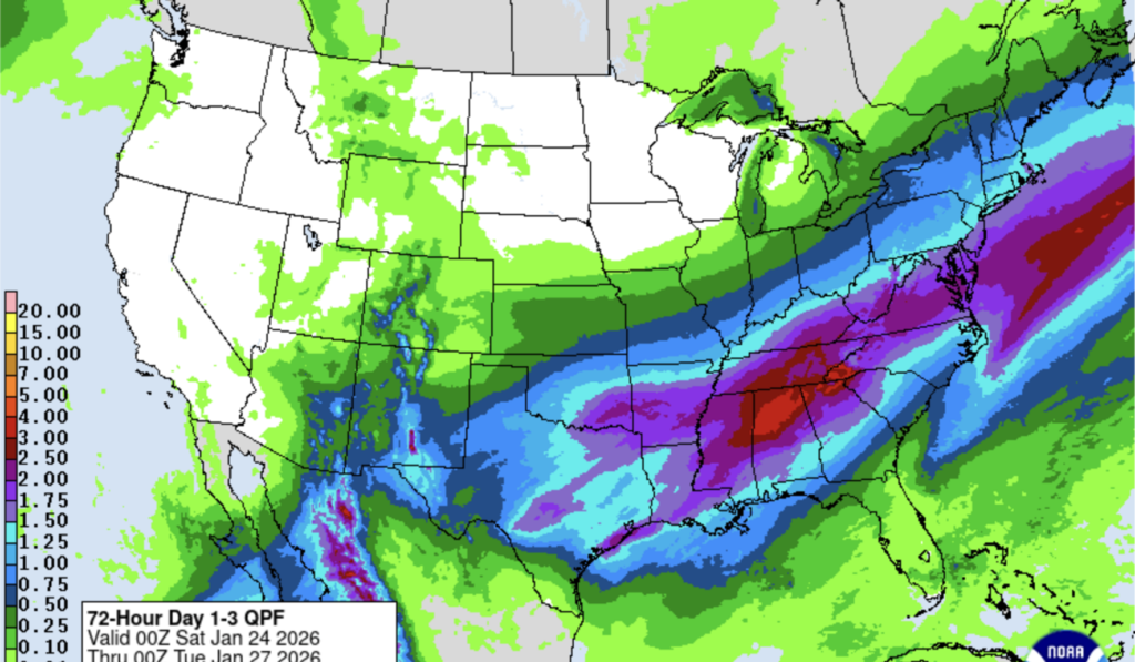
This report covers a major winter storm expected to hit the Washington region this weekend, where forecasters warn that heavy ice buildup — not just snowfall — could create the most severe impacts, potentially leaving hundreds of thousands without power and causing widespread travel and infrastructure disruptions.
The storm arriving this weekend is shaping up to be complex, with temperature profiles that favor both snow and a dangerous glaze of freezing rain. Forecast models are showing a narrow transition zone where warmer air aloft will melt falling snow before refreezing on contact with cold surfaces. That setup raises the risk that an otherwise headline-grabbing snowfall will be overshadowed by slick, weighty ice on trees and power lines.
Ice accumulation causes different kinds of damage than heavy snow, and the consequences are often more severe for utilities and street clearance efforts. A quarter-inch of ice clinging to branches and wires can add enough weight to snap limbs and pull down lines, and that weight multiplies quickly with thicker glazing. When power lines fail across densely populated corridors, outages can cascade and leave large numbers of customers without service for hours or days.
Historic outages in ice storms show how vulnerability is not distributed evenly; older neighborhoods with mature trees and overhead wiring see the worst results. Areas with buried lines or fewer large trees tend to fare better, but no location is immune if the storm intensifies or lingers. Repair crews face slow, labor-intensive work when ice-coated equipment and fallen trees block access routes and create safety hazards for linemen.
Travel risks extend beyond slick roads, too, because ice formed on bridges and overpasses can appear suddenly and catch drivers off guard. Airports and transit agencies are likely to face cascading delays if runways or rails ice over or if equipment fails during the event. The combination of slick surfaces and limited visibility can produce multi-vehicle pileups and lengthy shutdowns on major commuting corridors.
Critical infrastructure is particularly susceptible; sites that rely on backup power or single points of failure may see interruptions if crews cannot reach damaged equipment quickly. Communication towers and cellular sites can be affected when feeder lines go down or generators run out of fuel, complicating coordination for response teams. Hospitals and emergency services typically have redundancy, but extended outages stretch those safeguards and can disrupt routine operations.
Tree damage is a major factor in urban and suburban neighborhoods because ice accumulation adds weight while remaining unseen until branches break. That compound effect often translates into blocked streets and damaged roofs, creating hazards both during and after the storm. Municipal cleanup and utility restoration both slow when debris piles up, and those delays increase the time communities remain without essential services.
Forecast uncertainty remains a key caveat: small shifts in the storm’s track or in thermal layers can change the balance between snow, sleet, and freezing rain. Meteorologists are watching temperature gradients closely because a slightly warmer surface or a change in precipitation intensity could flip outcomes from manageable snowfall to dangerous icing. Those variables make preparedness and operational planning harder for agencies that must allocate crews and equipment in advance.
The timing and duration of the storm will determine how long impacts persist, with multi-day events increasing the odds of sustained outages and extended travel disruptions. Power restoration following significant ice damage is slower than after wind-driven tree failure because crews must work more deliberately to avoid creating new hazards. As forecasts continue to update, communities will be watching for shifts that alter where the heaviest icing and the worst downstream effects will occur.


