
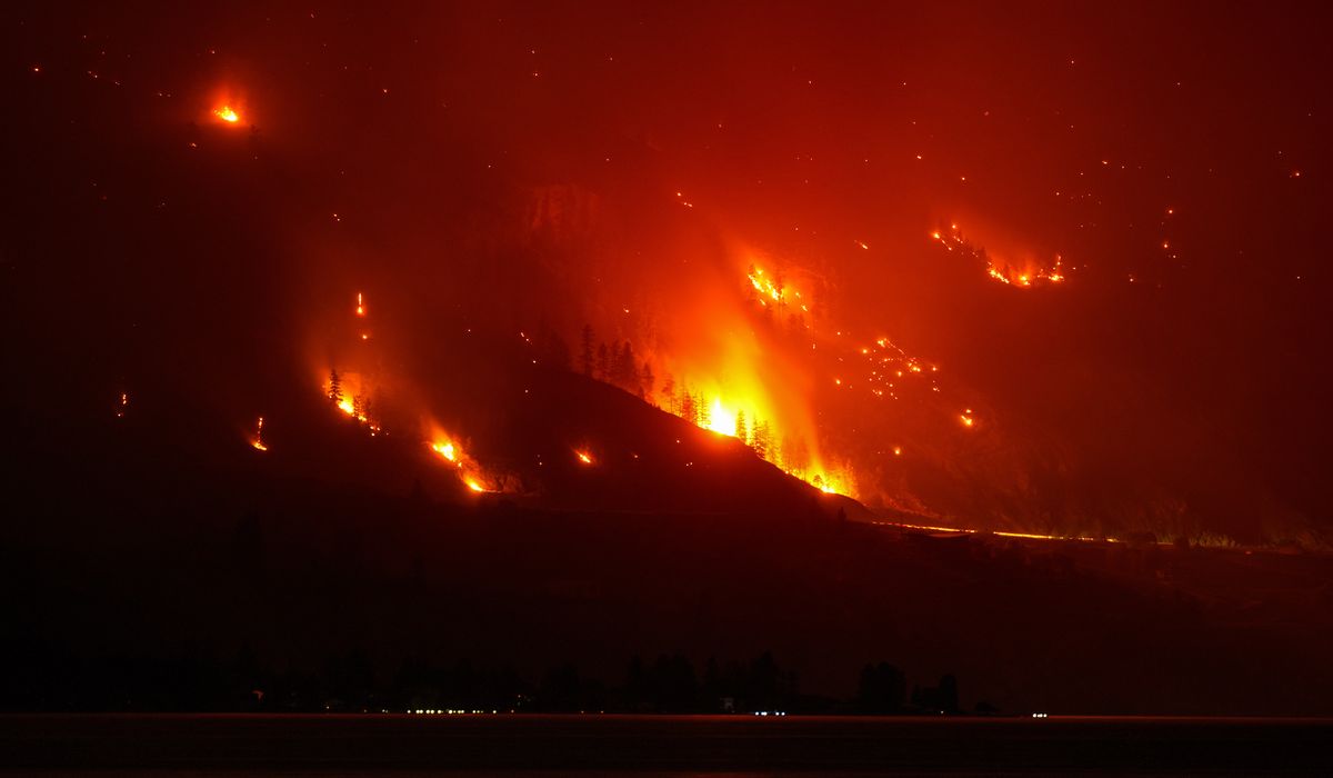
Wildfires across the western U.S. and Canada sent smoke into the sky, forced many people from their homes, and left others on edge as officials monitored fire behavior and possible evacuation orders.
Wildfires burning across the western U.S. and Canada on Sunday left some residents keeping a weary eye out for possible evacuation orders while others already forced to flee their homes waited to see how conditions would change. The blazes moved quickly in parched terrain and gusty winds, complicating containment efforts. Fire crews from local, state, and provincial agencies worked under difficult conditions to set lines and protect communities. Satellite imagery and aerial reconnaissance helped map the fires and guide tactical decisions.
Multiple fires stretched through forests, brush, and grasslands, feeding smoke that reduced visibility and turned skies hazy in cities far from any flame. Air quality alerts appeared in regions downwind, triggering health notices for sensitive groups and raising concerns about outdoor activities. Transportation corridors were affected in several areas as agencies evaluated closures and detours. Emergency managers emphasized the unpredictable nature of the situation as weather patterns shifted through the weekend.
Local officials issued mandatory evacuations for some neighborhoods and advisory notices for others, moving people to safety centers and staging areas. Evacuation orders varied by jurisdiction, reflecting differences in terrain, fuel loads, and fire behavior. Some residents packed vehicles and pets and left before flames reached populated areas, while others watched from nearby roads for updates. The mix of short-notice movement and longer-term displacement created logistical challenges for shelters and support services.
Firefighters relied on air tankers, helicopters, and ground crews to slow the spread and protect structures, often prioritizing communities over uninhabited landscapes. Crews worked through smoke and heat to build containment lines and remove hazardous fuels near homes. Mutual aid agreements brought reinforcements from neighboring states and provinces where possible. Incident commanders adjusted strategies as winds shifted and new spot fires ignited ahead of main fire fronts.
Public health officials issued warnings about smoke exposure, noting risks for children, older adults, and people with respiratory or heart conditions. Clinics and emergency rooms saw an uptick in visits related to smoke irritation and worsened chronic conditions. Officials encouraged monitoring air quality indexes and following local health guidance without issuing direct commands. The visibility of thick, yellowed skies underscored how far-reaching the effects of these fires can be.
Communities near the fires faced immediate property risks and longer-term recovery concerns about infrastructure and native ecosystems. Power utilities monitored lines and, in some cases, implemented precautionary outages to reduce ignition risks. Livestock owners and farmers navigated pasture losses and feed supply disruptions in affected counties. Local economies that depend on tourism and outdoor recreation braced for cancellations and a slow rebound.
Emergency communication networks played a crucial role as authorities pushed alerts through various channels and community volunteers helped check on vulnerable neighbors. Social media and local radio channels amplified official updates, while coordination centers compiled reports from multiple jurisdictions. Language access and outreach to isolated residents were important priorities amid rapidly changing evacuation statuses. The scale of the events demanded organized logistics for food, shelter, and medical support for those displaced.
Weather forecasts suggested a mix of short-term relief and persistent risk: cooler temperatures and moisture in some areas could slow the fires, but recurring dry conditions and gusty winds kept flare-ups possible. Fire managers said containment gains can be fragile, especially where fuels remain unburned and embers travel. Planning for mop-up operations and burn-out tasks began once crews secured lines. The timeline for rebuilding and restoring services remained uncertain for many impacted communities.
Scientists and land managers pointed to a combination of factors that influence these incidents, including prolonged drought, higher spring and summer temperatures, and accumulated forest fuels. Land-use patterns and previous fire suppression efforts also affect how intensely some landscapes burn today. Longer fire seasons and larger, more intense fires are part of a documented trend in recent years, prompting discussions about adaptation and long-term mitigation. Research and funding discussions continue as communities seek ways to reduce future risks while maintaining healthy ecosystems.
Neighboring jurisdictions and international partners provided resources and information as needed, reflecting the cross-border nature of regional fire seasons. Coordination between local, state, provincial, and federal agencies aimed to streamline resource requests and prioritize life-safety missions. Community organizers and relief groups mobilized to support evacuees and first responders with supplies and manpower. As the situation evolved, officials committed to sharing updates and maintaining situational awareness across affected areas.