
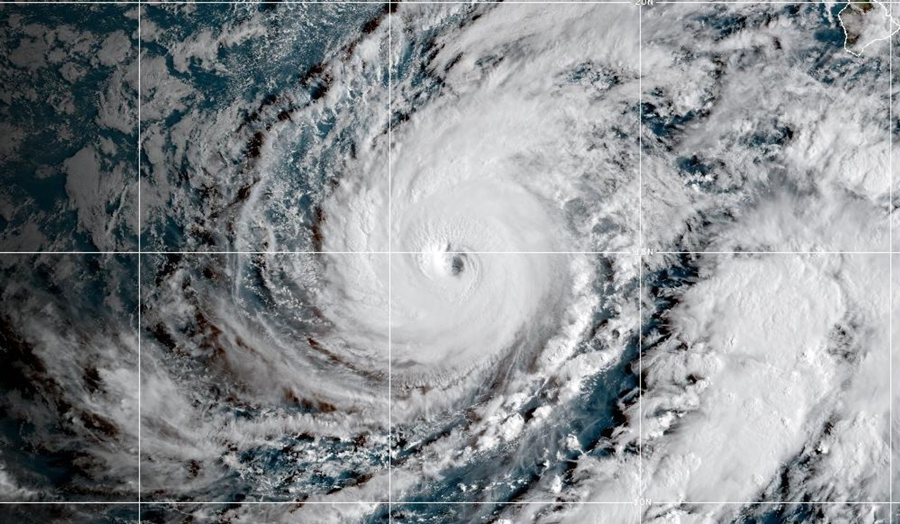
Officials in Hawaii warned residents and visitors to brace for heavy rains, flooding and possible mudslides as Hurricane Lowell, a major Category 3 storm tracked toward the islands and drew attention from the National Hurricane Center.
Hurricane Lowell has the hallmarks of a powerful system: sustained winds and an expansive rain shield that can squeeze out prolonged, intense precipitation. Officials in Hawaii urged residents and visitors to prepare for heavy rains, flooding and possibly mudslides, stressing that the combination of saturated ground and steep terrain raises the risk of dangerous slides. Emergency managers emphasized that even areas not directly in the storm’s eye can experience severe flooding from torrents of rain.
Local authorities moved quickly to remind people about basic readiness: identify evacuation routes, secure loose outdoor items, and have supplies on hand. Many island communities have narrow roads and limited evacuation corridors, so a sudden flood or mudslide could isolate neighborhoods. Officials noted that preparation is not about panic but about reducing needless risk when a Category 3 hurricane is in play.
The National Hurricane Center has been monitoring Lowell’s strength and projected track, issuing forecasts and advisories as conditions evolve. Those advisories focus on expected rainfall bands and the potential for coastal flooding in exposed areas, even where the strongest winds may stay offshore. Forecast uncertainty remains, and emergency planners said they are watching for any shifts that would change which communities face the worst impacts.
Flooding concerns are central because rain-driven damage can be widespread and long lasting, overwhelming drainage systems and clogging rivers and streams. Mudslides are a particular worry on slopes that have already been weakened by prior storms or wildfires, where loose soil can come down quickly and without much warning. Officials warned that roads, bridges and utilities could be affected, and that travel should be avoided during heavy downpours.
Public safety messaging stressed staying informed through official channels and heeding local advisories about closures and sheltering. While the word “evacuation” is sometimes necessary for immediate danger zones, many places rely on targeted, short-term moves away from the most vulnerable slopes and flood plains. Shelters, when opened, are set up with basic needs in mind and are coordinated by county emergency management teams.
Business and infrastructure operators were asked to take proactive steps to protect assets, from clearing drains to moving critical equipment out of basements and low-lying rooms. Utilities partnered with emergency crews to stage repair teams where access permits, and transportation agencies reviewed plans to keep essential routes open. The goal is to limit downtime and speed recovery once the storm passes.
Residents were reminded that the worst effects of a storm like Lowell can lag behind the initial winds, with flooding and landslides continuing after the eye moves away. Officials encouraged people to avoid riverbeds, steep slopes and any areas that show signs of recent erosion or instability. Staying off the roads during heavy rain preserves emergency response capability and lowers the chance of becoming a rescue case.
Community leaders tried to balance urgency with calm, urging practical steps rather than alarm. The message was clear: take the risk seriously, follow official guidance, and prepare so that, if the worst arrives, families and neighborhoods can recover more quickly. Authorities reiterated that updates from the National Hurricane Center and local emergency services would guide decisions as Lowell moves through the region.